03 — ARTWORK
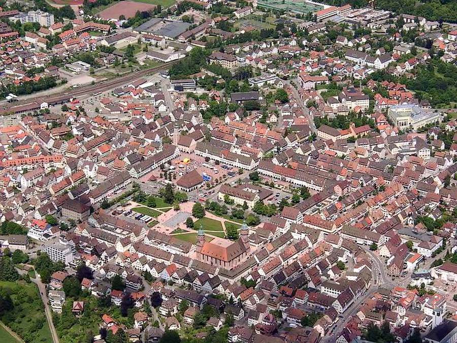
Aerial view
SCHICKHARDT, Heinrich II · 1599 →
- MEDIUM
- Photo
- TYPE
- Other
PALETTE
HOVER OR TAP A SWATCH FOR NAME, SHARE AND HEX. SAMPLED FROM THE IMAGE — INDICATIVE, NOT A PIGMENT ANALYSIS.
DEVELOPMENT BUILD — NOT FOR PUBLIC USE. CONTRIBUTE ON GITHUB.
03 — ARTWORK
SCHICKHARDT, Heinrich II · 1599 →
PALETTE
HOVER OR TAP A SWATCH FOR NAME, SHARE AND HEX. SAMPLED FROM THE IMAGE — INDICATIVE, NOT A PIGMENT ANALYSIS.
COMMENTARY
UNDERLINED TERMS ARE DEFINED IN THE GLOSSARY.
Freudenstadt in southwestern Germany lies in the Black Forest, about 65 km southwest of Stuttgart. In 1599 Schickhardt began to draw up a plan for the new town of Freudenstadt ("Town of Joy"), founded as a refuge for Protestants from Salzburg, and intended by the Duke of Württemberg as a military and commercial basemolded foot of a pillar or column providing the transition from the plinth to the shaft.. Schickhardt designed an ideal town on a grid plan, with the streets intersecting like the lines on a nine men's morris board-game.
Freudenstadt was severely damaged by fire during World War II. The central city, including the Renaissance arcades in the marketplace and the Evangelical church (1601-08), was rebuilt in its original form.
@online{wga-rfbe7bb9ee77af2,
  author       = {Krén, Emil and Marx, Daniel},
  title        = {Aerial view by SCHICKHARDT, Heinrich II},
  organization = {{Web Gallery of Art}},
  date         = {2026-09-13},
  url          = {https://beta.wga.hu/artists/schickhardt-heinrich-ii-rb5c8d6f16d094a/aerial-view-rfbe7bb9ee77af2},
  urldate      = {2026-09-13},
  langid       = {english}
}
ACCESSED 2026-09-13. REPLACE THE AUTHOR FIELD WITH THE COMMENTARY AUTHOR WHERE ONE IS NAMED.


